Trip report - Juan de Fuca
The Juan de Fuca trail runs from Jordan River up to Port Renfrew on the West Coast of Vancouver Island. It’s in the Juan de Fuca park and runs 47km from one end to the other.
Comparisons with the West Coast Trail are common because the West Coast Trail starts at Port Renfrew and heads further north. In fact, sitting in the pub at the end of the trail, you can see where the entrance to the West Coast Trail is. There are four trail heads on the Juan de Fuca Trail and the trail bus will drop you off at them.
Getting there
Just a note that, with one brief exception on the way back 1, I got there and back without using a car, from North Vancouver. So that meant a bus, a bus, a ferry (seabus), a train (the skytrain) to Bridgeport station, a bus, a ferry (BC ferries) and a bus to get to downtown Victoria. Then I stayed the night at a hotel 2 and took the trail bus in the morning.
It took about 2.5 hours to get to the ferry terminal. It takes an hour by car, plus all the waiting around, so that really surprised at how fast, easy and cheap it was.
Cycling there was something I considered, but riding from North Vancouver to the ferry terminal is horrendous and dangerous on the best of days.
Total cost: $2.50 (transit in Victoria), $4.45 (two zones on translink), $19.20 (bc ferry), $50 (trail bus)
The trail bus is the expensive part of the whole trip, if you’ve got more people and vehicle, the cost of the trail bus can quickly outweigh the cost of the ferry.
Day 1: China beach to Chin beach
- Distance: 19.39km
- Time: 8h 08m
- Elevation: 988m up 📈 and the same down 📉
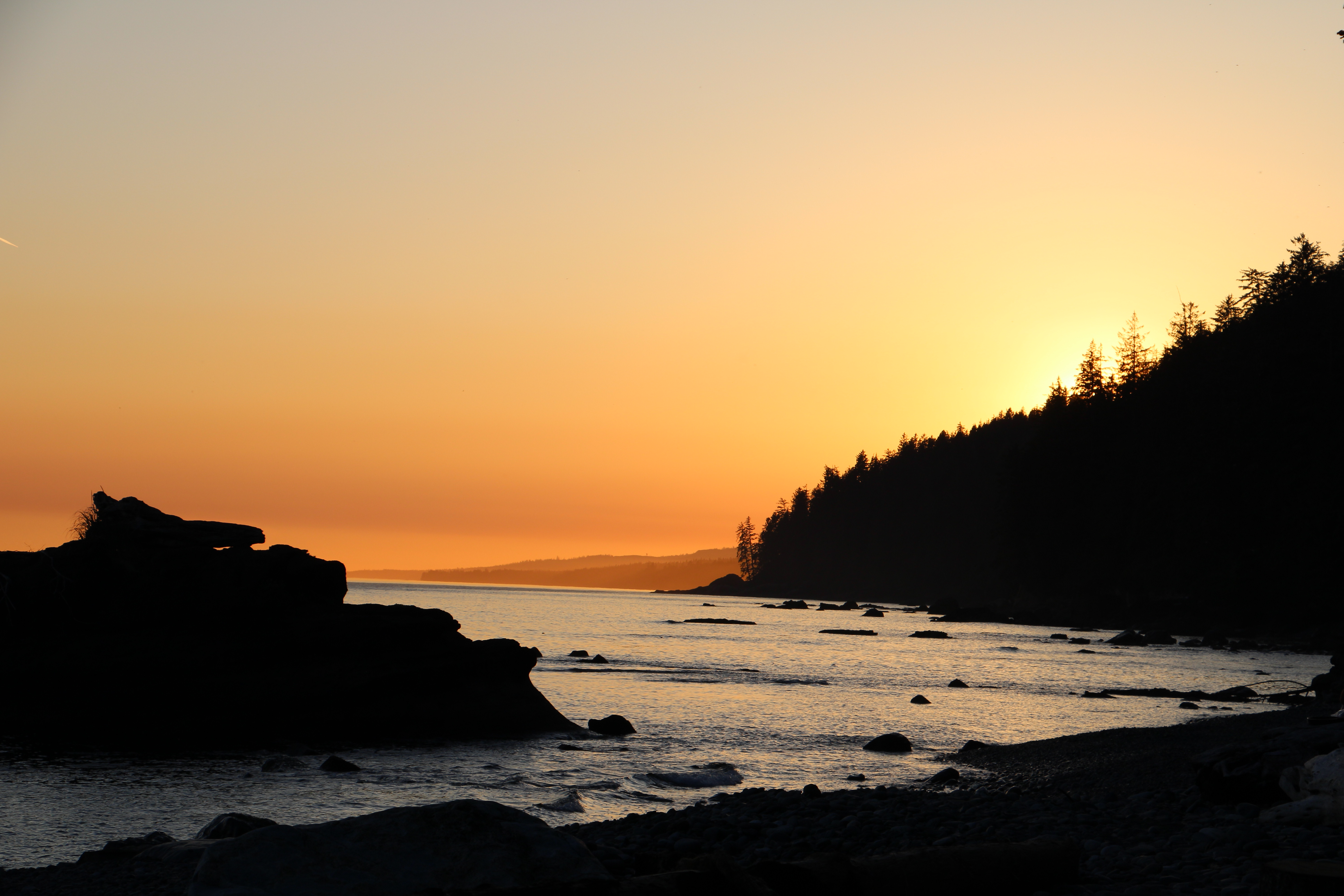
Perhaps one of the more confusing naming schemes out there, but this was China beach to Chin beach. The trail bus dropped me off at around 8:30 and after a quick repack, I took off for the first campsite, 9km north along the trail. The weather was just great for this day, nice and sunny with a light breeze coming off the sea.
The trail follows the coast and so you get the absolute delight that is the west coast, mild temperatures, lovely beaches and so on. I hit the first campsite, 9km in at about 11am or so, which is way to early to camp. At that point I decided to just press on the next 11km - knowing that the next 11km was some of the hardest on the trail.
I would have settled for a campsite earlier than Chin beach, at 21km (according to the map 3), the last few km were a hard push. The terrain is just continuously steep up and down as the trail goes up and down each creek. I gained almost 1000m, but ended up at sea level. The terrain is steep and also dry and dusty and technical to walk up and down.
Every campsite has tent pads, which for people with hiking pole tents, like me, not ideal. Fortunately that first night I found a lovely pad free spot with a good place for my hammock on the beach. I was very happy and tired.
Day 2: Chin beach to Little Kuitsche Creek
- Distance: 11.70km
- Time: 5h 07m
- Elevation: 552 up 📈 and the same down 📉
On day two, I noticed that I’d overdone it on day one and I had a slow and sluggish start to the day, but was still able to press on and glad when I finished. This day was easier than yesterday, mostly. It still starts off tough with lots of up and down and then a reasonable sized (200m) hill.
Then you come out on to the glorious Sombrio beach, complete with a waterfall falling onto the beach, a whale feeding and quite a lot of people. Sombrio beach is also a trail head, with road access so there’s quite a lot of people which is a bit of a shame. But a few km either way from the beach and it predictably thins out again.
The campsite is not a beach campsite, its up in the trees. Water access is close, but down a hill that’s under construction and I found a bit of a challenge in my flip flops. Time to give up on flip flops as camp shoes and go for something more rugged. A super sunny day with hiking on the beach, fantastic.
Day 3: Little Kuitsche Creek to Port Renfrew
- Distance: 16.51km
- Time: 5h 05m
- Elevation: 481 up 📈 and the same down 📉
This is the easiest part of the trail, but is still lots of steep up and down. There were actually a few more flat bits on this one, which was nice. It turns out, that most people doing the trail aim for four days of hiking (I combined the first two days into one by going straight to Chin beach) so that meant I kept seeing the same people on the trail and campsites, which was nice.
The weather was overcast, with bright spots in the afternoon, a lovely west coast day. Once you hit Botanical Beach, it’s really easy and flat with wide trails and lots of people. I did a hike around Botany Bay and then had to hike the 4km or so into town on road. After all that up and down, that was a nice break.
A few beers and a veggie burger in the pub at the end of the road, and I was ready to hop in the trail bus and repeat my trip home.
Notes
We’ve had a very hot, dry spring so far and so there were muddy parts on the trail, but they were few and far between. There was much less mud than on the West Coast Trail which I did mid-June 2022.
Everyone is going to compare this to the West Coast Trail, because it’s right there. In comparison, the Juan de Fuca trail is:
- More steep elevation changes, but no ladders.
- Less muddy, but that might have been due to weather.
- Shorter, but more access points.
- Less beach walking and much, much more forest walking.
The main difference is beaches, once you’ve got past Walbran Creek (if you are heading north), then you’ll find lots and lots of beach and flat hiking. That’s because as you go further north, the coast is no longer protected by the Olympic peninsula and over the millennia, waves crashing in off the Pacific have created fantastic beaches to explore.
This marked the end of my boots. I bought Scarpa boots last year and they have completely fallen apart. There were holes all the way through both sides, at the end of each beach I had to stop and empty the beach out of my boots. A post about my new boots soon.
This was also my first trip with 100% homemade meals, they worked pretty well and helped me save money without having to buy expensive pre-made dehydrated meals. Will post about that soon also.
Getting there and back without a car was cool and would recommend it.
-
My friend who was kind enough to give me a bed for the night on the way back, drove me home from the bus stop. Next morning I walked back to the bus and continued that way. ↩
-
The bus leaves at 6:45am and so I wanted a hotel downtown to make it easy to get to. ↩
-
My GPS and the trail signs did not agree and were always a couple of km out. ↩