Fifth trip - West Coast Trail
The West Coast Trail is one of the most popular hiking trips in the world and has for many years been a rite of passage for many people in BC. In June I noticed that a spot was available - they normally all get booked for the year as soon as the reservations open in January - and took it. Heading from the south to the north on June 20th.
Instead of spending the weeks cycling or running I focused on hiking with a back pack, doing my usual local trails with varying weights of backpacks and also doing the Stein Valley.
I’d read lots of posts about the trail and the toll the 75km takes on people. Over 100 people are year are evacuated usually due to hypothermia or injuries from slipping. The weeks leading up to the trip were mostly full of anxiety… would I be fit enough, would I have the right gear and so on. I went full on as light as possible, was this a bad move? We’d find out. Oh and I was doing it solo, the most dangerous way to do it.
Sorry, this is a long one.
Getting there
For me leaving a car at Port Renfrew or Bamfield wasn’t option. Port Renfrew has paved access, Bamfield is accessible only by logging road. The two main options are the Bamfield ferry to Port Alberni or the Trail Bus. I took the bus from Victoria to the start and they picked me up at Bamfield and took me back to Nanaimo. The bus was cool, but its a bus on logging roads, you’ll get a comfier ride on the ferry.
Direction
Just a note that I had no choice in direction. The two main ways are north to south or south to north. Options from Nitinaht are available, which is basically in the middle. The hardest parts of the trail are by far the sections from Walbran Creek south. Specifically the section to the west of Camper Bay and east of Camper Bay to Gordon River.
If you are doing south 👉 north, you do the hardest parts first. If you are doing north 👉 south, you will do the hardest parts last. Some say, its better to save the hardest part to last since you will have eaten food and have a lighter pack. I was happy I did south to north and got the tough stuff done while fresh, it just got easier every day.
Day one: Gordon River to Camper Bay
13.35km in 5h 33min
The bus deposited us at the entrance to the park. A bunch of nervous hikers all checking out each others backpacks and asking how long they’ll take and so on. A really nice person gave us an orientation and talked us through the video. For the route you’ll need to keep a map on hand and have a list of the tide times. A lot of trail is on the beach and you’ll need to know what the tide is (they give you this, don’t lose it). This means you will also need a device that tells you the time.
Most of the chatter was about how small my backpack and was how light it was. At this point I wasn’t quite sure if I was just completely stupid for going so small and light.
The park ranger told us that the first campsite Thrasher takes most people 4 hours to get to - it’s only 5km away. The next campsite Camper Bay takes another 4 hours to get to. They then got into details about going from Thrasher to Camper Bay by see - it involves a boulder field that takes about 3 hours and then dangerous cliffs and so on.
A lot of this seemed to be an exercise in caution, understanding the map and tides. I imagine that the rangers have to deal with people of all abilities on this trail and they have to deal with pulling people out when it goes wrong, a tough job.
To get to the start you have to take a ferry and at about 10:30am I was off, on the West Coast Trail, solo - the most dangerous way to do it.
On the other side of the river you are faced with a vertical ladder to scale. The first of many and telling of what is to come:
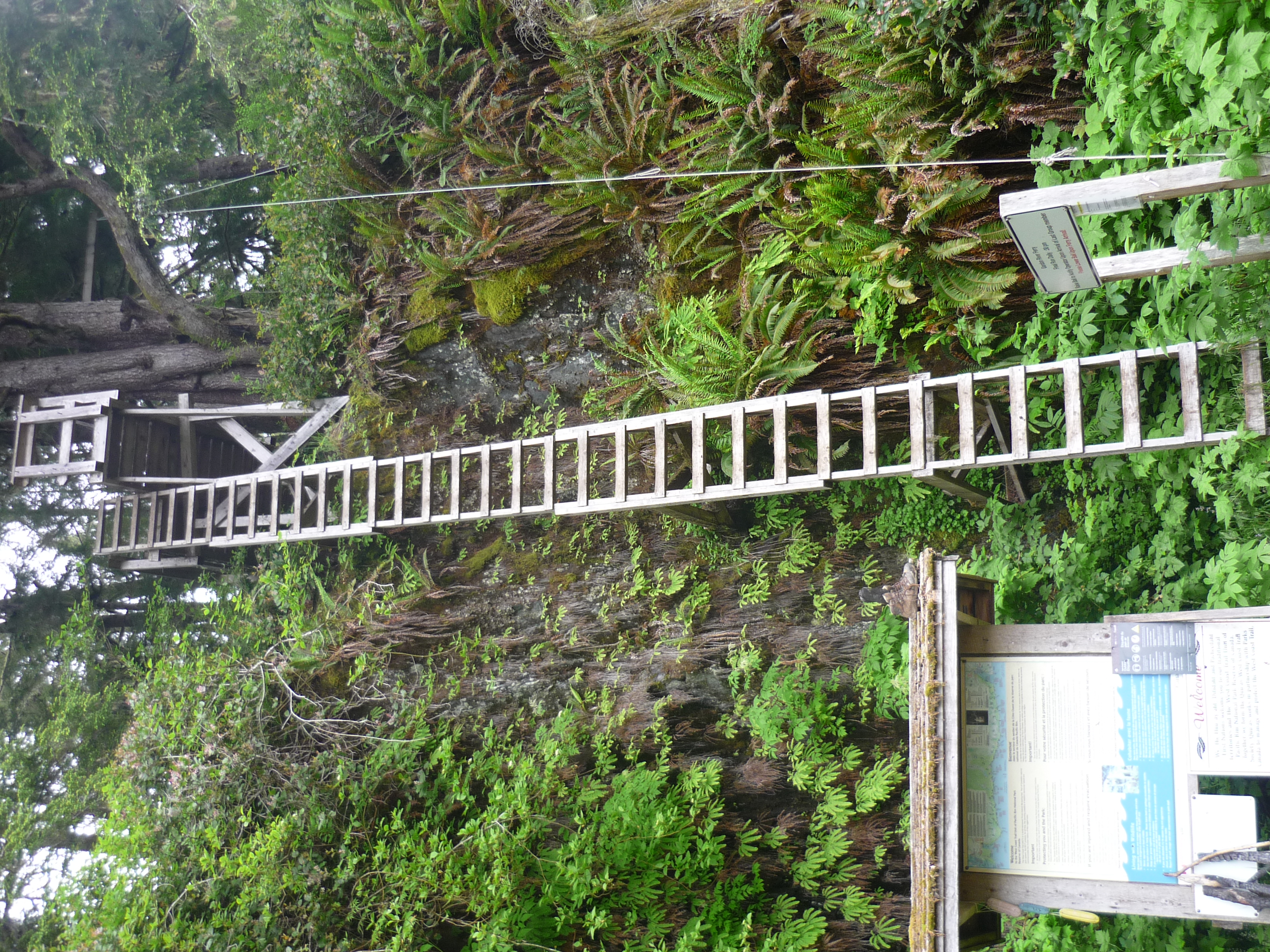 This is the start. Get used to it.
It took me 2 and a bit hours to get to the junction to Thrashers. I was hiking at my usual comfortable speed I was doing in North Vancouver and overtaking people who started on the 8am ferry. It felt comfortable for me.
At this point I would end up at Thrashers at 1pm ish and have an entire day to wait for tides to go around the coast. And I’d have to wait in the morning for the tides again. That would get me to Campers on day 2. I’m not good at waiting around and the boulder field and only part of the map marked “Very dangerous” didn’t appeal. Plus, I really wanted to ensure I finished on schedule… the day after the West Coast Trail is my daughters graduation, I promised not to miss it.
I pushed on to Camper Bay and got there in two and a bit hours.
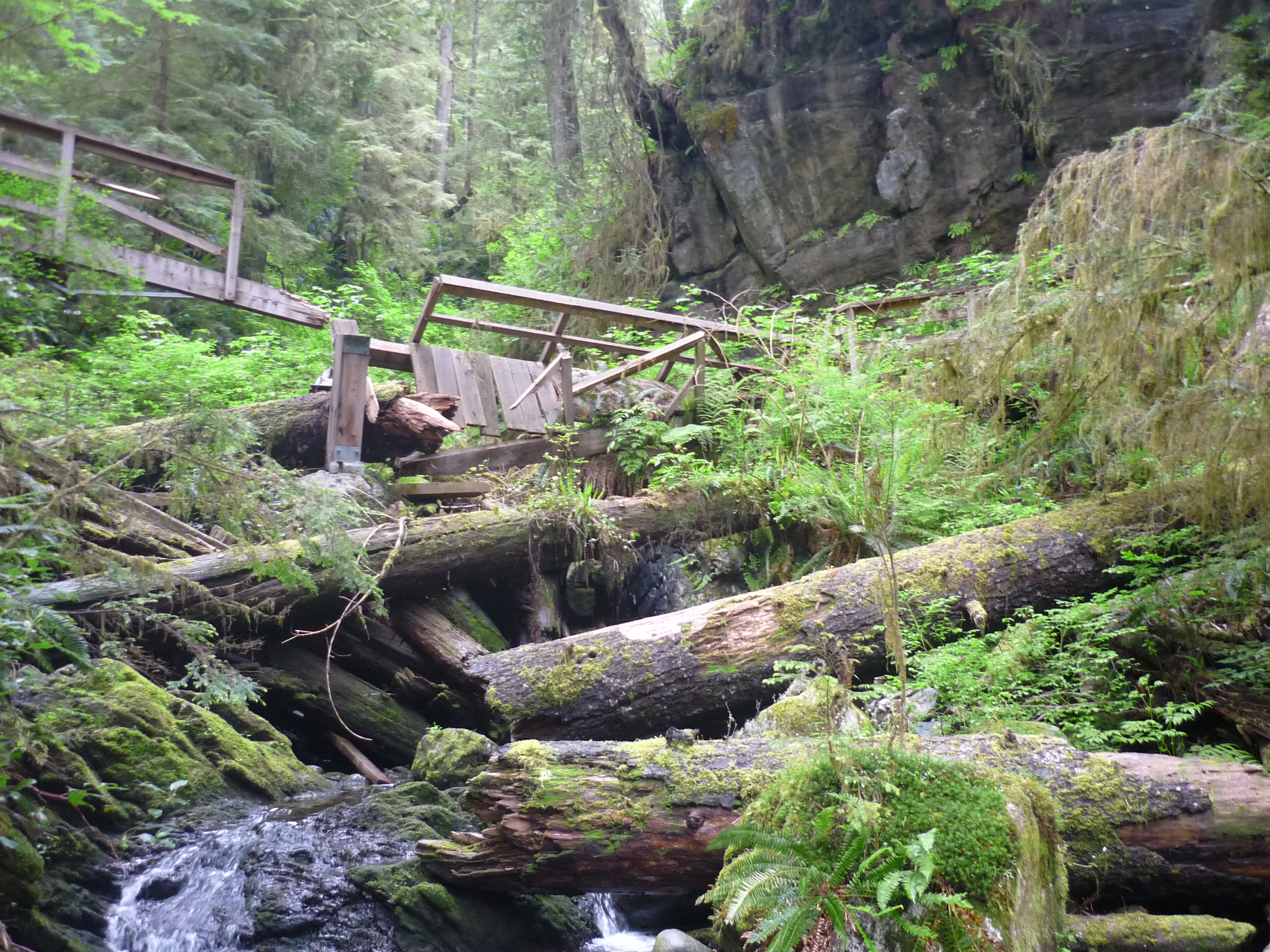 So many broken bridges and boardwalks. This coast is tough on infrastructure.
The trail Gordon River to Thrashers felt like a hike on the more remote North Vancouver trails (eg: Three chop, upper lynn loop etc). Just throw in a bunch of ladders. Thrashers to Camper Bay was a muddy hell hole of broken boardwalks, mud, deep mud, slippy everything and mud. Parts of this were not that much fun. People I chatted to later said the boulder field on the coast wasn’t fun either so 🤷♂.
Anyway I took the cable car across and camped at Camper Bay for the night. Met a nice group from Alberta who let me share their camp fire. Mostly we spoke about how I managed to do it so fast, when some of their group took over 6 hours to get to Thrashers 🤷♂. The advantage of doing this kind of trail regularly and having a super light backpack I guess.
Day two: Camper Bay to Bonilla Point
16.8km in 7h 24min
When the sun rose, I staggered out of bed, made my tea and oats and packed up. First one out on the trail up north. For this day there were multiple places I could camp, it was more about where I wanted to finish.
The section out of Camper Bay continued the trend of being broken boardwalks, mud, bog, ladders, rivers, bridges, ladders, more ladders, mud and so on. Did I mention mud? There’s a lot of that. When you get to Walbran Creek, it mud comes to and end you was able to exit from the forest onto the beach for the first time.
 So many ladders and its hard to get a feel of how steep they are from these pictures.
I still felt good at this point, strong and powering through things. I will admit, I did find some of the ladders a bit scary at times. Heights aren’t my thing and having a backpack and poles etc makes it harder. Doing some of those in pouring rain, with heavy backpacks must be hard. Camper Bay to Walbran is rough.
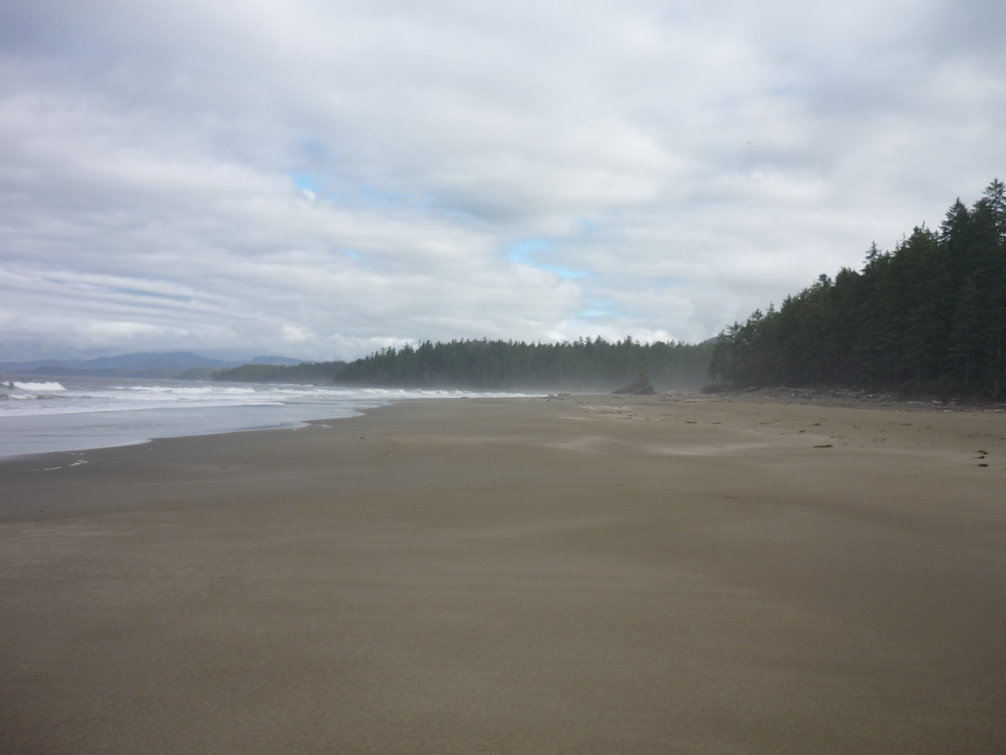
 Coming out of the forest onto the beach felt pretty good.
I had lunch at Walbran Creek and tried to cross - silly idea. I got my feet and gaiters totally drenched and was only half way across when it got really deep. So I back tracked and went across the creek using the cable car higher up. But that gave me the excuse to have a cup of tea, change socks and dry things out a little.
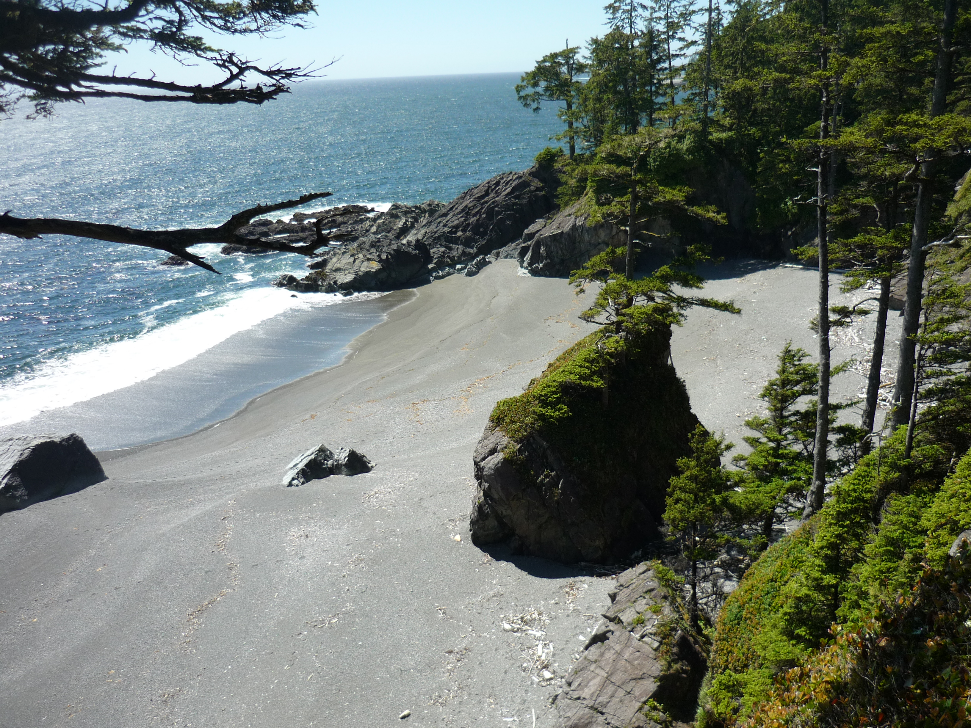
After that it was gorgeous beach walking for a while. I stopped at Bonilla Point to camp because its cute, has a waterfall and was deserted. And it stayed that way, being the only person there all night.
Bear in mind, not all beach walking is easy. The sand is at an angle and often very soft so you slip a lot. You’ll also be climbing over rocks, seaweed, rock shelves and so on.
That night the weather closed it and we got wet west coast mist for many hours, so I hid in the tent most of the night.
Day three: Bonilla Point to Tsusiat Falls
25.24km in 9h 52min
Tsusiat Falls is one of the most popular camping sites on the West Coast Trail. It marks a destination for hikers from the north. For them its the last site before a long trek to Cribbs through an area that’s low in water and has no formal campsites. Similarly from the south, once you go past Cribbs there isn’t anything much till Tsusiat. You can camp almost anywhere, but there is a 5km or so stretch between the two with no camping due to animal activity.
I headed out with some damp gear, but nothing too bad from last night heading. Cribbs was really close to Bonilla and I went through there at 9:30am, so I wasn’t going to stop there. This was pretty much all on the beach and easy hiking as the sun started to work it’s way through.
The trail alternated with little bits inland and the beach before inland towards Nitinaht. I was feeling pretty good here still and powering along quite happily. Views were getting better and the trails were improving.
 I wish every hike was this beautiful.
At the Nitinaht ferry there’s the Crabshack which serves crabs and other delicacies like bags of chips and pop. I went for a grill cheese which took 40 minutes, but was worth it. A quick ferry ride across the river led me on to the trail so I could keep powering towards Tsusiat.
At this point the trail is high up on a cliff, close to the edge with fantastic views. And here I met my first bear. It saw me first and darted at 90% to me across the trail. I quickly saw 2 cubs shoot up a tree. I backed of and fumbled for my bear spray shouting “Bear” at the top of my voice to warn others and something to make noise to keep the bear aware of where I was.
After 4 minutes of not seeing any bear and shouting until I felt like an idiot, I inched forward, bear spray at the ready. It was long gone.
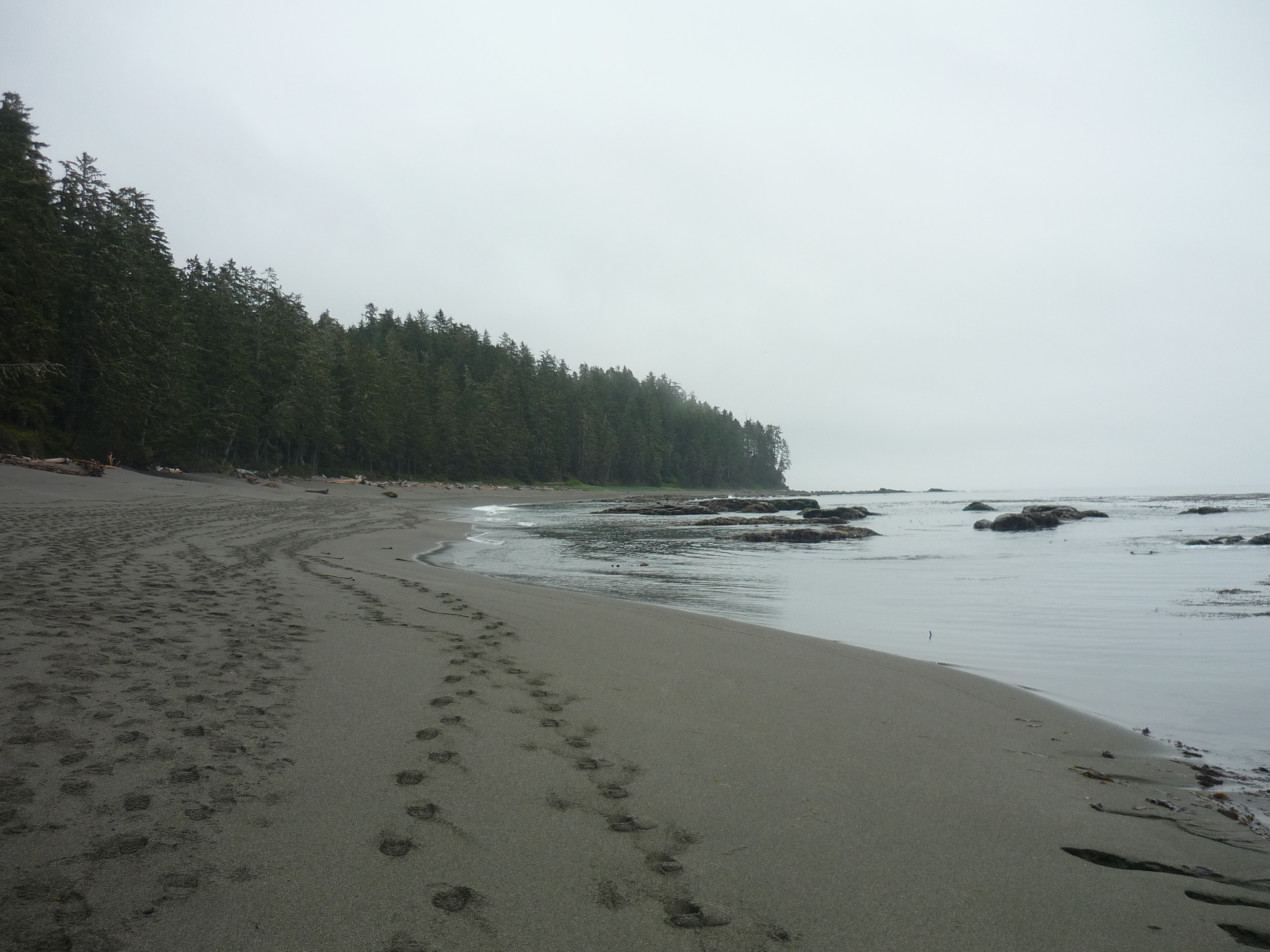
 One of the many random beaches without people on that you see from the trail. Just amazing.
The rest of hike to Tsusiat was uneventful, but getting even more pretty including a cool sea arch that I only just made the tides for. That night I was surrounded by tons of people but the waterfall and sea meant I didn’t hear much.
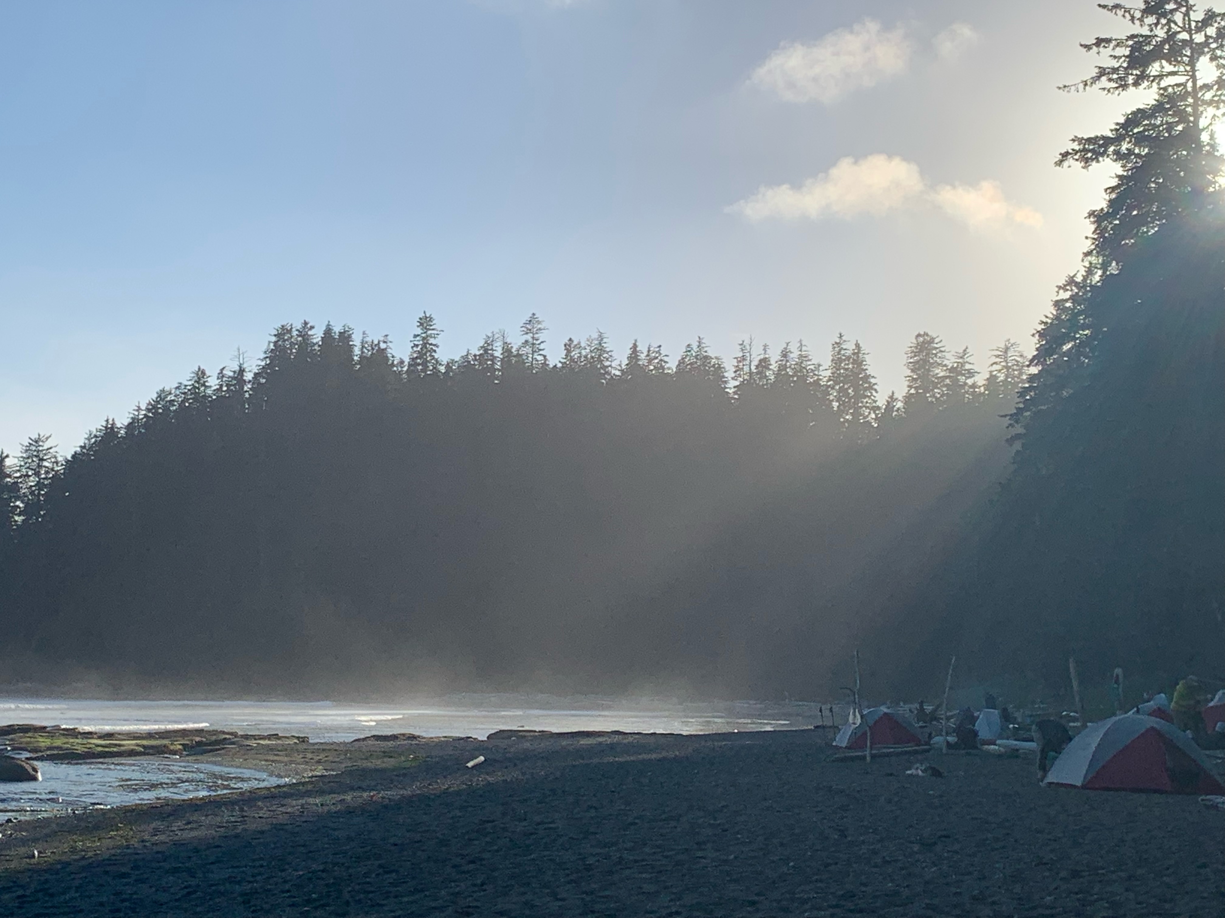
 Tents and waterfall at Tsusiat.
Day four: Tsusiat Falls to Michigan Creek
12.64km in 5h 14min
Again, the number of campsites is limited, Michigan Creek is the last formal campsite. Darling River campsite is closed due to bear activity, so Michigan seemed like the best bet.
This is a combination of beach and trail up on the cliffs. Probably one of the most scenic sections with views down to the rocks and bluffs and beaches. Some serious ladders and a bit of mud, but overall the trail is really good at this point.
Tsocowis Creek is a lovely spot with a nice campsite that had no one there. I stopped, put up the hammock and had a good nap. The hike to Michigan Creek is along the beach with a couple of streams to ford.
Hiking was pretty easy and I still felt good, able to power along and got to Michigan Creek in the early afternoon. I spent a while failing to set up my hammock, none of the trees were quite right. Finally settled on a spot in the trees with my tent and chilled… only to find I’d lost my camera 1. Aargh. I knew the last time I used it was Tsocowis Creek.
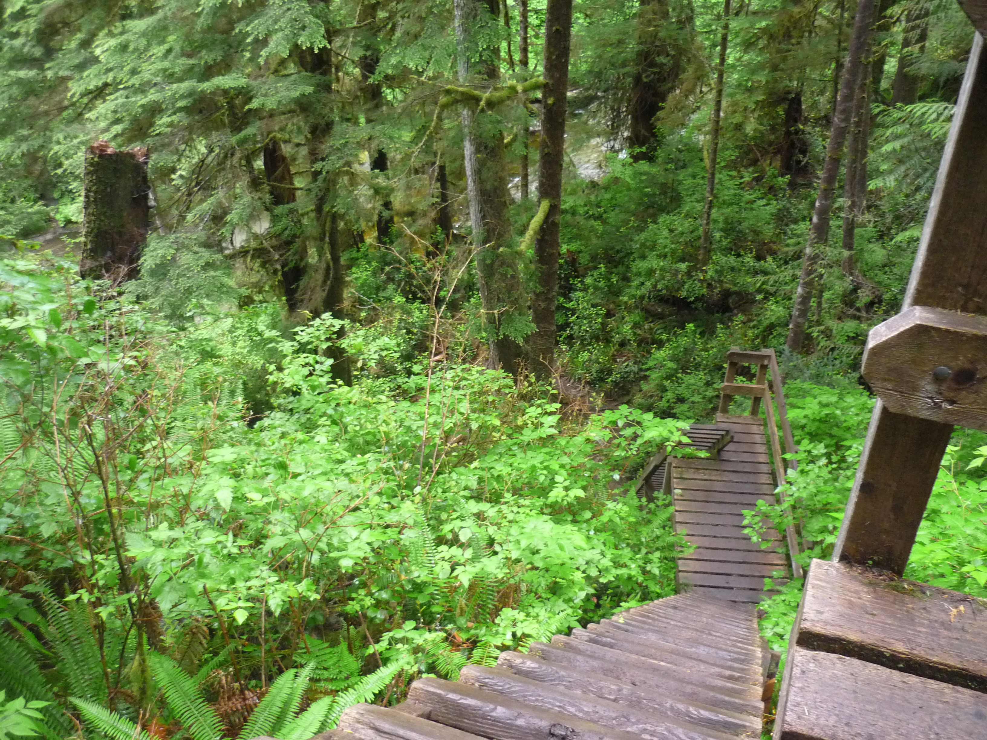
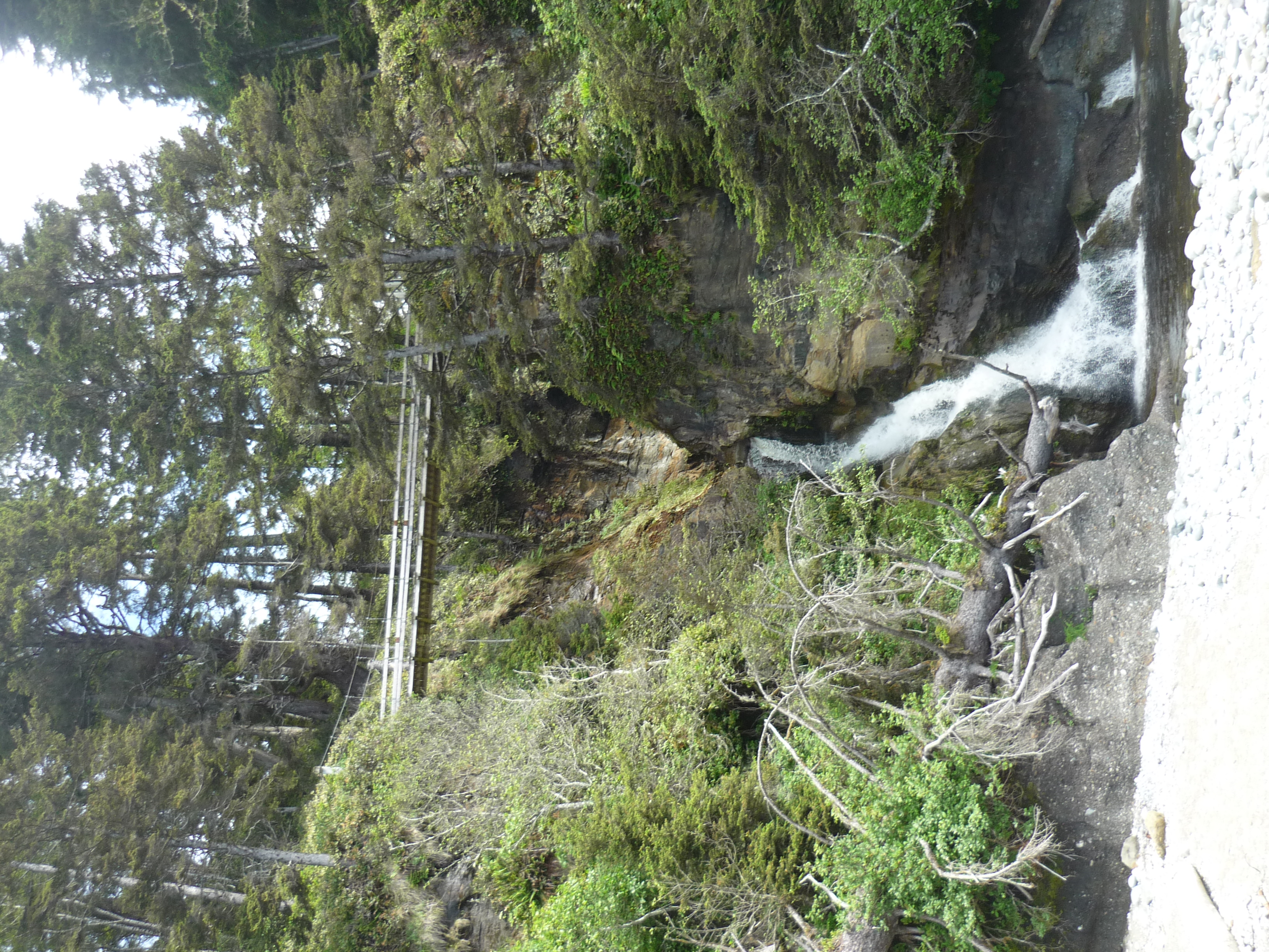 Bridge over waterfall at Tsocowis Creek.
After ages searching the campground, asking people and retracing my steps I was at a loss. So I grabbed my Spot, my bear spray and hiked the 9km return to Tsocowis Creek to see if it was there. It wasn’t. So really I did 21km+ this day, but 9km of it was in the sun without a backpack - nice and easy.
Later that night someone found the camera next to their tent. Yay 😃
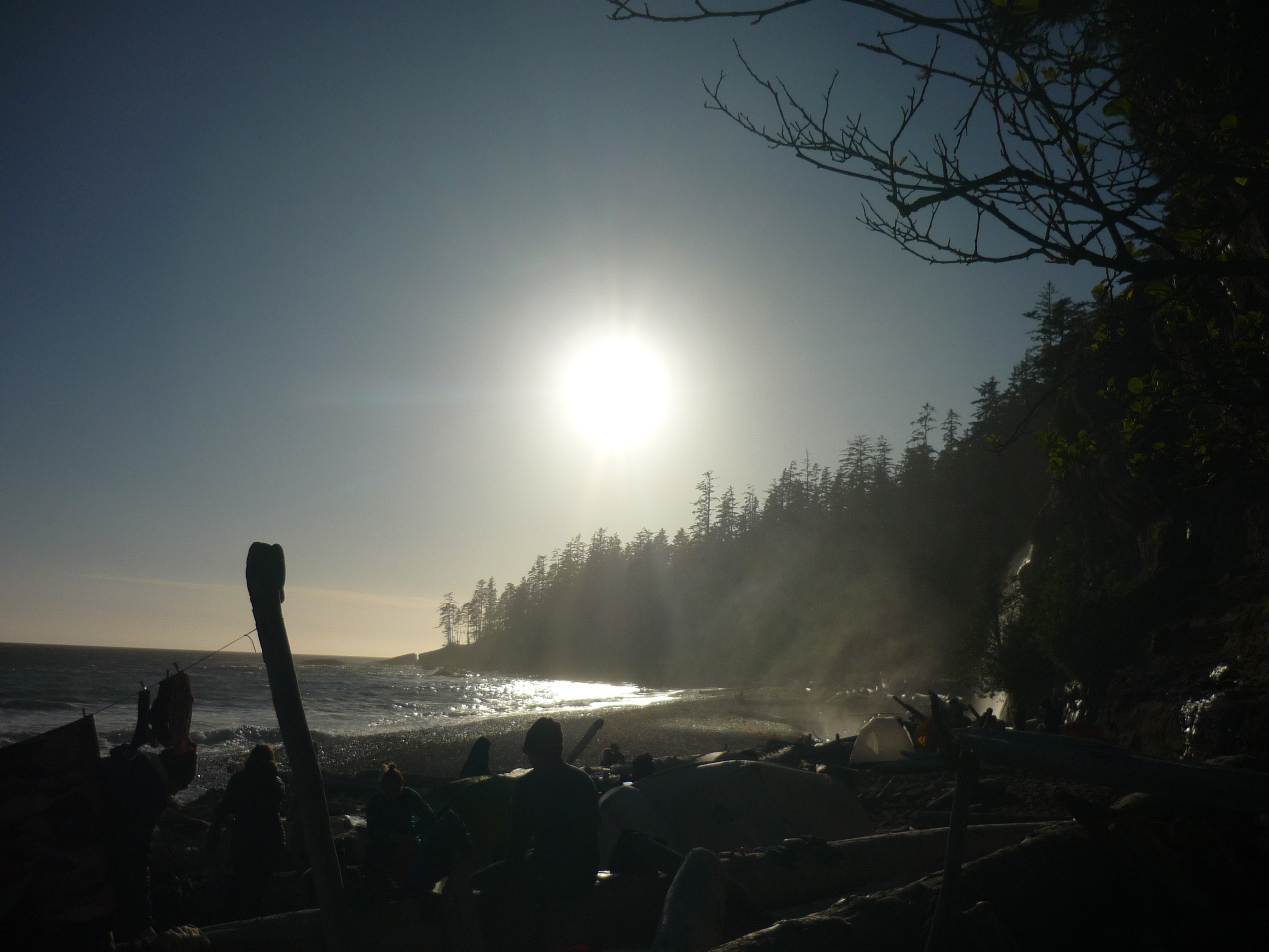
 Evening at Michigan Creek
Day five: Michigan Creek to Pachena Access
12.62km in 3h 24min
As you can probably tell the times are getting shorter and shorter for similar distances. The differences in the trail, the quality of the infrastructure and the quality of the trail is like night and day. If the first day is a hike on the hardest North shore trail, this is a walk on Stanley Park. It’s mostly in great condition.
There was another bear sighting, which ran off quickly once it spotted me. Sea lion rock is awesome and is a few rocks full of sea lions. Was as advertised.
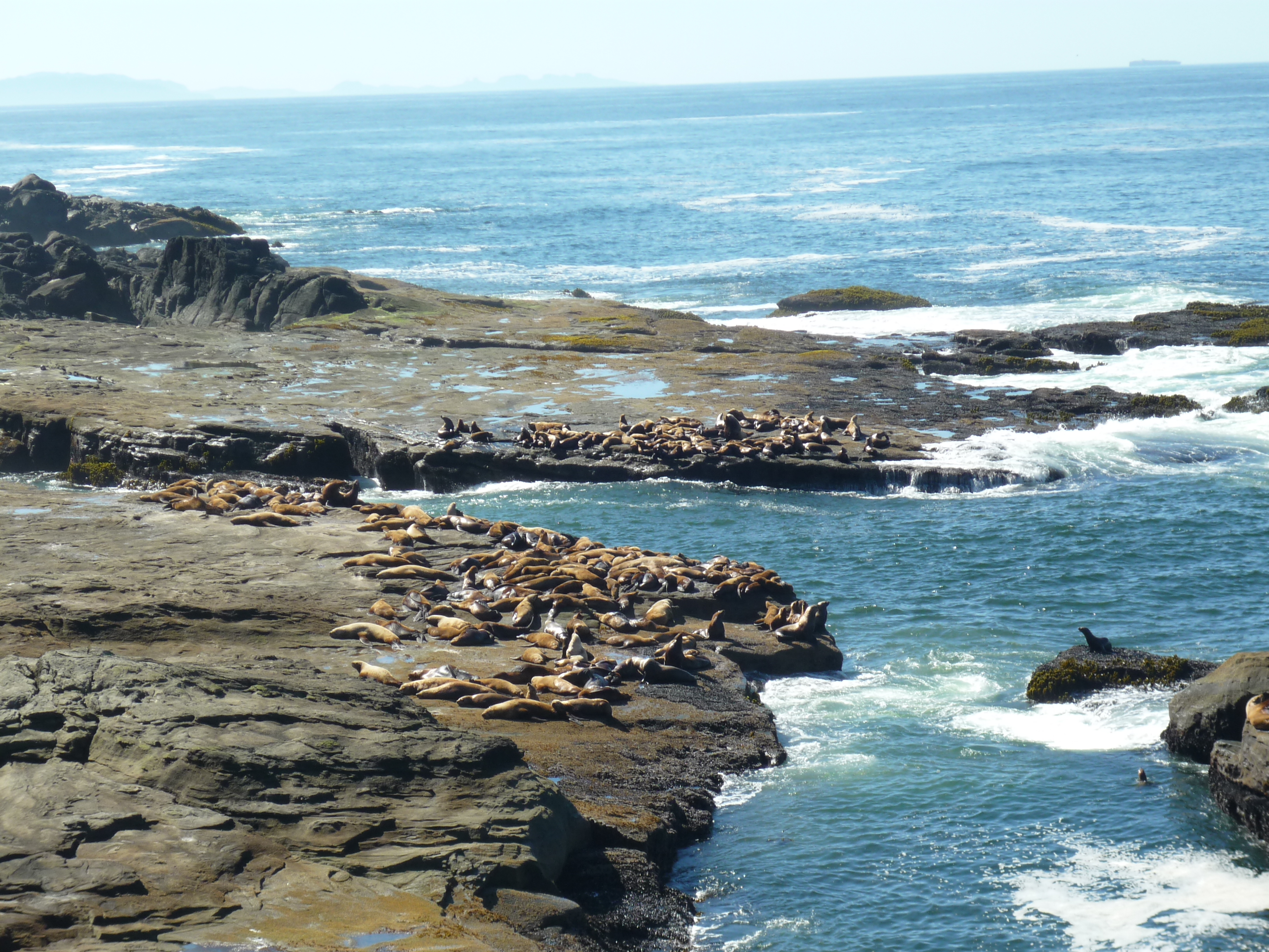 Sea lion rock is loud and fun to watch.
In a few hours I turned up at the beautiful beach at Pachena and I was done at 12:30pm, one day early.
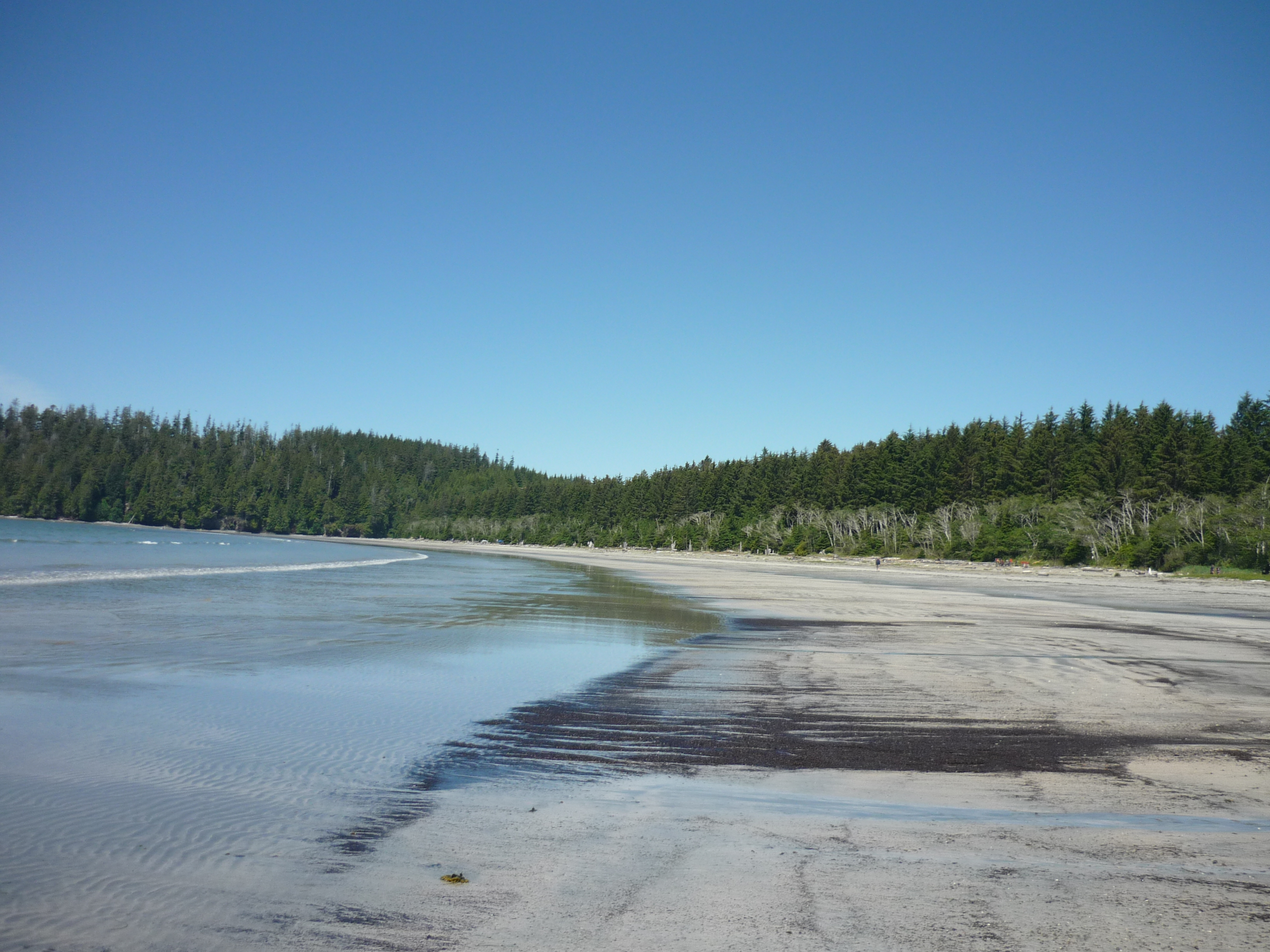 The end at Pachena beach.
The trail bus crew were able to move my reservation up a day and by 5:30pm I was in Nanaimo waiting for a ferry home and kinda wishing I was able to turn back and do the whole trail once again.
Summary
The trail is beautiful in that special west coast way, similar to Haida Gwaii and so on. Long empty beaches, bears, eagles, ravens, sea otters and just continuous beauty. I hope I never get tired this amazing coast.
The trail is muddy beyond anyway I thought possible. It’s really bad and that makes it really slippy. It’s what makes the trail harder and I can’t imagine how bad it is in the rain. You need gaiters and poles for the mud.
Difficulty is subjective. I didn’t find it that hard, because I’ve spent years hiking on the North Shore and it is similar to the harder trails. If you don’t do this kind of hiking regularly, if you’ve got a big backpack you will find it very tough. I think back to the experience some people had said they had hiking (almost none) and their backpack weight (very heavy) on the bus to the trail and cringe, I hope they made it in the time they had allotted.
Light is better when it comes to backpacking. The majority of accidents are people slipping and if you are fatigued from carrying a 60lb backpack and trying to negotiate this trail, you are more likely to have a serious slip. I didn’t feel I missed anything.
It’s more sanitised than I expected. I did go 4 hours at a time without seeing people and I did camp by myself. But those were the exceptions, it’s become quite popular and all the rivers have bridges or cable cars. There is support and exit points if you have an accident and that’s all good. But I’m craving something more remote, maybe the North Coast trail, Haida Gwaii etc. The possibilities are endless.
I loved this hike and my time on the trail so much and I missed it as soon as I was done. I would do it again. Those last three days in the sun were amazing and I ❤️ this part of the world, so very much.
 Felt good to be done and now I can get to a hot shower and my daughters graduation. And maybe a beer.
👋 I’ll be back.
-
I used an old camera for pictures. This meant I could leave my phone off and only use it for emergencies and not have to carry a battery pack. This was much lighter and worked well. ↩